
Petikko topographic map
Interactive map
Click on the map to display elevation.
About this map
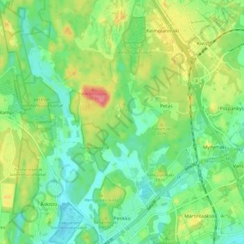
Name: Petikko topographic map, elevation, terrain.
Average elevation: 44 m
Minimum elevation: 17 m
Maximum elevation: 92 m
Other topographic maps
Click on a map to view its topography, its elevation and its terrain.
Seutula
Finland > Southern Finland > Vantaa
Seutula, Kivistön suuralue, Vantaa, Helsinki sub-region, Uusimaa, Southern Finland, Mainland Finland, 01760, Finland
Average elevation: 43 m
Veromies
Finland > Southern Finland > Vantaa
Veromies, Aviapoliksen suuralue, Vantaa, Helsinki sub-region, Uusimaa, Southern Finland, Mainland Finland, 01511, Finland
Average elevation: 36 m