
Kuujjuaq (village) topographic map
Interactive map
Click on the map to display elevation.
About this map
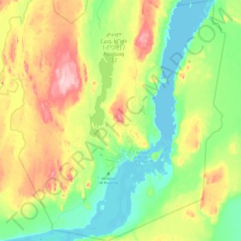
Name: Kuujjuaq (village) topographic map, elevation, terrain.
Location: Kuujjuaq (village), Kativik, Québec, Canada (58.02119 -68.53671 58.26798 -68.22299)
Average elevation: 64 m
Minimum elevation: -1 m
Maximum elevation: 188 m