
Thank you for supporting this site ❤️
Make a donation
Make a donation
Khamis Mushayt topographic map
Click on the map to display elevation.
Thank you for supporting this site ❤️
Make a donation
Make a donation
About this map
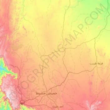
Name: Khamis Mushayt topographic map, elevation, terrain.
Location: Khamis Mushayt, 'Asir Region, Saudi Arabia (18.14420 42.48769 19.12710 43.18698)
Average elevation: 1,904 m
Minimum elevation: 1,092 m
Maximum elevation: 2,982 m
Thank you for supporting this site ❤️
Make a donation
Make a donation