
Weiler im Allgäu topographic map
Interactive map
Click on the map to display elevation.
About this map
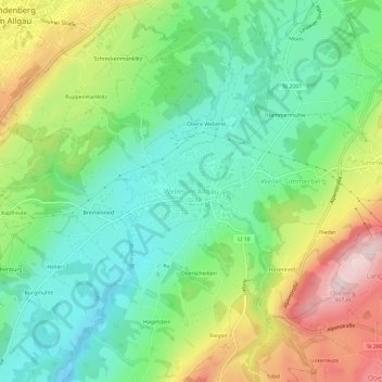
Name: Weiler im Allgäu topographic map, elevation, terrain.
Average elevation: 695 m
Minimum elevation: 577 m
Maximum elevation: 907 m
Other topographic maps
Click on a map to view its topography, its elevation and its terrain.
Bremenried
Deutschland > Bayern > Landkreis Lindau > Weiler im Allgäu
Bremenried, Weiler im Allgäu, Weiler-Simmerberg, Landkreis Lindau, Bayern, 88161, Deutschland
Average elevation: 694 m