
Mughal Sarai topographic map
Interactive map
Click on the map to display elevation.
About this map
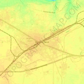
Name: Mughal Sarai topographic map, elevation, terrain.
Location: Mughal Sarai, Chandauli, Uttar Pradesh, India (25.24073 83.08513 25.32073 83.16513)
Average elevation: 78 m
Minimum elevation: 59 m
Maximum elevation: 83 m