
Thank you for supporting this site ❤️
Make a donation
Make a donation
Côte Baudette topographic map
Click on the map to display elevation.
Thank you for supporting this site ❤️
Make a donation
Make a donation
About this map
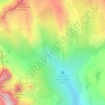
Name: Côte Baudette topographic map, elevation, terrain.
Average elevation: 2,471 m
Minimum elevation: 2,124 m
Maximum elevation: 2,917 m
Thank you for supporting this site ❤️
Make a donation
Make a donation
Other topographic maps
Click on a map to view its topography, its elevation and its terrain.
Refuge du Mont Thabor
France > Provence-Alpes-Côte d'Azur > Hautes-Alpes > Névache
Average elevation: 2,490 m