
Tatew topographic map
Interactive map
Click on the map to display elevation.
About this map
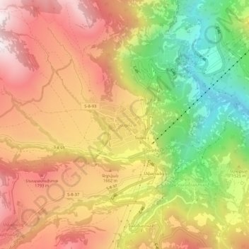
Name: Tatew topographic map, elevation, terrain.
Location: Tatew, Տաթևի տարածաշրջան, Provinz Sjunik, 3218, Armenien (39.36403 46.22367 39.40403 46.26367)
Average elevation: 1,524 m
Minimum elevation: 947 m
Maximum elevation: 2,007 m