
Thank you for supporting this site ❤️
Make a donation
Make a donation
Hambegamuwa topographic map
Click on the map to display elevation.
Thank you for supporting this site ❤️
Make a donation
Make a donation
About this map
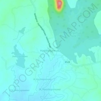
Name: Hambegamuwa topographic map, elevation, terrain.
Location: Hambegamuwa, Monaragala District, Uva Province, Sri Lanka (6.52123 80.92856 6.56123 80.96856)
Average elevation: 124 m
Minimum elevation: 104 m
Maximum elevation: 253 m
Thank you for supporting this site ❤️
Make a donation
Make a donation