
Thank you for supporting this site ❤️
Make a donation
Make a donation
Sande topographic map
Click on the map to display elevation.
Thank you for supporting this site ❤️
Make a donation
Make a donation
About this map
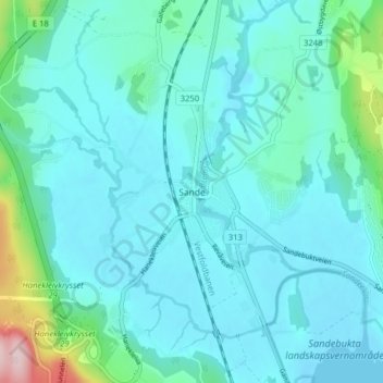
Name: Sande topographic map, elevation, terrain.
Location: Sande, Holmestrand, Vestfold og Telemark, 3070, Norway (59.56729 10.18750 59.60729 10.22750)
Average elevation: 37 m
Minimum elevation: -1 m
Maximum elevation: 269 m
Thank you for supporting this site ❤️
Make a donation
Make a donation
Other topographic maps
Click on a map to view its topography, its elevation and its terrain.