
龙川县 topographic map
Interactive map
Click on the map to display elevation.
About this map
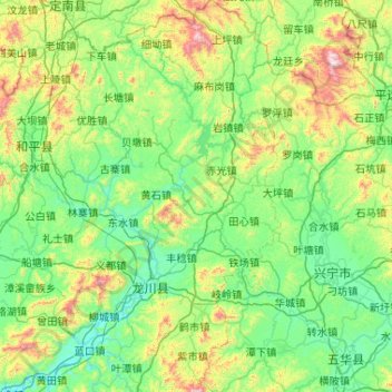
Name: 龙川县 topographic map, elevation, terrain.
Location: 龙川县, 河源市, 广东省, 中国 (23.84909 115.05302 24.79605 115.58845)
Average elevation: 286 m
Minimum elevation: 42 m
Maximum elevation: 1,313 m
Other topographic maps
Click on a map to view its topography, its elevation and its terrain.