
Mátraszentimre topographic map
Interactive map
Click on the map to display elevation.
About this map
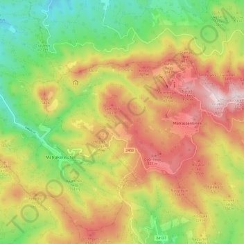
Name: Mátraszentimre topographic map, elevation, terrain.
Average elevation: 590 m
Minimum elevation: 268 m
Maximum elevation: 942 m
Other topographic maps
Click on a map to view its topography, its elevation and its terrain.
Ágasvár
Hungary > Heves > Mátraszentimre
Ágasvár, Mátraszentimre, Gyöngyösi járás, Heves, Great Plain and North, 3082, Hungary
Average elevation: 560 m