
Barbosa topographic map
Interactive map
Click on the map to display elevation.
About this map
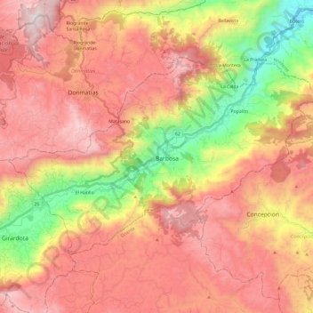
Name: Barbosa topographic map, elevation, terrain.
Location: Barbosa, Valle de Aburrá, Antioquia, 057, Colombia (6.36395 -75.45219 6.51289 -75.21663)
Average elevation: 1,990 m
Minimum elevation: 1,059 m
Maximum elevation: 2,716 m