
Thank you for supporting this site ❤️
Make a donation
Make a donation
Leatherhead topographic map
Click on the map to display elevation.
Thank you for supporting this site ❤️
Make a donation
Make a donation
About this map
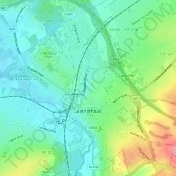
Name: Leatherhead topographic map, elevation, terrain.
Location: Leatherhead, Mole Valley, Surrey, England, United Kingdom (51.28413 -0.34710 51.31500 -0.31120)
Average elevation: 54 m
Minimum elevation: 26 m
Maximum elevation: 118 m
Thank you for supporting this site ❤️
Make a donation
Make a donation
Other topographic maps
Click on a map to view its topography, its elevation and its terrain.