
Mascanho topographic map
Interactive map
Click on the map to display elevation.
About this map
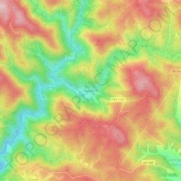
Name: Mascanho topographic map, elevation, terrain.
Location: Mascanho, Jou, Murça, Vila Real, 5090-077, Portugal (41.44062 -7.48910 41.48062 -7.44910)
Average elevation: 614 m
Minimum elevation: 451 m
Maximum elevation: 756 m
Other topographic maps
Click on a map to view its topography, its elevation and its terrain.