
Višegrad topographic map
Interactive map
Click on the map to display elevation.
About this map
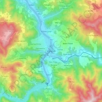
Name: Višegrad topographic map, elevation, terrain.
Location: Višegrad, Visegrad municipality, Republika Srpska, 73240, B&H (43.74441 19.25335 43.82441 19.33335)
Average elevation: 565 m
Minimum elevation: 288 m
Maximum elevation: 1,063 m