
Thank you for supporting this site ❤️
Make a donation
Make a donation
Hoa topographic map
Click on the map to display elevation.
Thank you for supporting this site ❤️
Make a donation
Make a donation
About this map
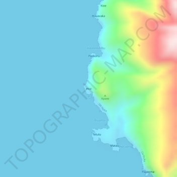
Name: Hoa topographic map, elevation, terrain.
Location: Hoa, Ua Huka, Marquesas Islands, French Polynesia, France (-8.92247 -139.61371 -8.92237 -139.61361)
Average elevation: 73 m
Minimum elevation: 0 m
Maximum elevation: 393 m
Thank you for supporting this site ❤️
Make a donation
Make a donation