
Morton topographic map
Click on the map to display elevation.
About this map
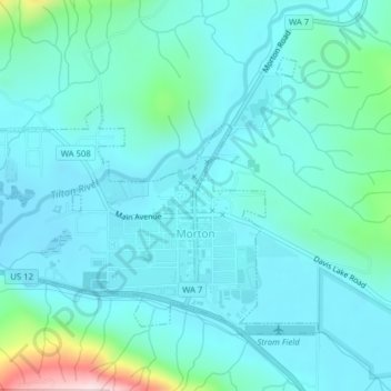
Name: Morton topographic map, elevation, terrain.
Location: Morton, Lewis County, Washington, United States (46.55011 -122.30137 46.56922 -122.26288)
Average elevation: 328 m
Minimum elevation: 265 m
Maximum elevation: 671 m
Other topographic maps
Click on a map to view its topography, its elevation and its terrain.