
Alabaster Caverns State Park topographic map
Interactive map
Click on the map to display elevation.
About this map
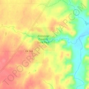
Name: Alabaster Caverns State Park topographic map, elevation, terrain.
Average elevation: 518 m
Minimum elevation: 475 m
Maximum elevation: 545 m
Other topographic maps
Click on a map to view its topography, its elevation and its terrain.
Muskogee County
United States of America > Oklahoma
Muskogee County, Oklahoma, United States of America
Average elevation: 190 m
Yukon
United States of America > Oklahoma > Yukon
Yukon, Oklahoma, United States of America
Average elevation: 399 m
Keetonville
United States of America > Oklahoma > Keetonville
Keetonville, Rogers County, Oklahoma, United States of America
Average elevation: 208 m
Fallis
United States of America > Oklahoma > Fallis
Fallis, Oklahoma, United States of America
Average elevation: 284 m