
Thank you for supporting this site ❤️
Make a donation
Make a donation
Westford topographic map
Click on the map to display elevation.
Thank you for supporting this site ❤️
Make a donation
Make a donation
About this map
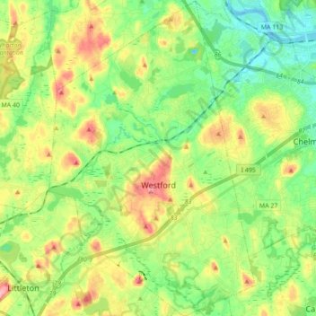
Name: Westford topographic map, elevation, terrain.
Location: Westford, Middlesex County, Massachusetts, United States (42.52619 -71.49801 42.65377 -71.38474)
Average elevation: 69 m
Minimum elevation: 26 m
Maximum elevation: 139 m
Thank you for supporting this site ❤️
Make a donation
Make a donation