
Kanlaon topographic map
Interactive map
Click on the map to display elevation.
About this map
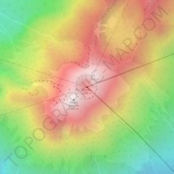
Name: Kanlaon topographic map, elevation, terrain.
Average elevation: 1,959 m
Minimum elevation: 1,391 m
Maximum elevation: 2,430 m
Other topographic maps
Click on a map to view its topography, its elevation and its terrain.
Escalante
Philippinen > Negros Occidental > Escalante
Escalante, Negros Occidental, Western Visayas, 6124, Philippinen
Average elevation: 39 m
Negros
Philippinen > Negros Occidental > Himamaylan
Negros, Himamaylan, Negros Occidental, Western Visayas, Philippinen
Average elevation: 114 m
Negros Occidental
Philippinen > Negros Occidental
Negros Occidental, Western Visayas, Philippinen
Average elevation: 125 m