
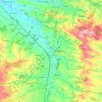
Zell an der Pram topographic map
Interactive map
Click on the map to display elevation.
Zell an der Pram
Zell an der Pram liegt auf 367 m Höhe im Innviertel. Die Ausdehnung beträgt von Nord nach Süd 8,5 km, von West nach Ost 5,2 km. Die Gesamtfläche beträgt 23,3 km². 13,7 % der Fläche sind bewaldet, 75,5 % der Fläche werden landwirtschaftlich genutzt. Als Gewässer durchfließt die Pram den Ort.
About this map
Name: Zell an der Pram topographic map, elevation, terrain.
Average elevation: 406 m
Minimum elevation: 344 m
Maximum elevation: 499 m