
Cordero topographic map
Interactive map
Click on the map to display elevation.
About this map
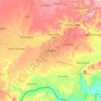
Name: Cordero topographic map, elevation, terrain.
Average elevation: 566 m
Minimum elevation: 402 m
Maximum elevation: 671 m
Other topographic maps
Click on a map to view its topography, its elevation and its terrain.
Pavia
Venezuela > Estado Lara > Municipio Iribarren
Pavia, Parroquia Unión, Municipio Iribarren, Estado Lara, Venezuela
Average elevation: 702 m