
Thank you for supporting this site ❤️
Make a donation
Make a donation
Adarki topographic map
Click on the map to display elevation.
Thank you for supporting this site ❤️
Make a donation
Make a donation
About this map
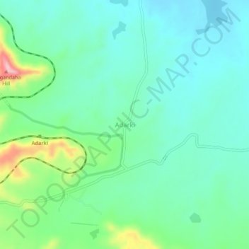
Name: Adarki topographic map, elevation, terrain.
Location: Adarki, Phaltan, Satara, Maharashtra, India (17.90408 74.18713 17.94408 74.22713)
Average elevation: 694 m
Minimum elevation: 648 m
Maximum elevation: 834 m
Thank you for supporting this site ❤️
Make a donation
Make a donation