
Hinterrugg topographic map
Interactive map
Click on the map to display elevation.
About this map
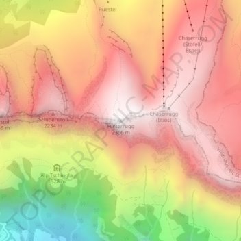
Name: Hinterrugg topographic map, elevation, terrain.
Average elevation: 1,762 m
Minimum elevation: 843 m
Maximum elevation: 2,306 m
Other topographic maps
Click on a map to view its topography, its elevation and its terrain.
Säntis
Schweiz > Sankt Gallen > Wahlkreis Toggenburg > Wildhaus-Alt St. Johann
Säntis, Wildhaus-Alt St. Johann, Wahlkreis Toggenburg, Sankt Gallen, 9658, Schweiz
Average elevation: 1,933 m
Wildhaus
Schweiz > Sankt Gallen > Wahlkreis Toggenburg > Wildhaus-Alt St. Johann
Wildhaus, Wildhaus-Alt St. Johann, Wahlkreis Toggenburg, Sankt Gallen, 9658, Schweiz
Average elevation: 1,244 m