
Niederweningen topographic map
Interactive map
Click on the map to display elevation.
About this map
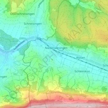
Name: Niederweningen topographic map, elevation, terrain.
Location: Niederweningen, Bezirk Dielsdorf, Zürich, 8166, Schweiz (47.48086 8.35768 47.52887 8.39209)
Average elevation: 556 m
Minimum elevation: 432 m
Maximum elevation: 834 m