
Thank you for supporting this site ❤️
Make a donation
Make a donation
Koleczkowo topographic map
Click on the map to display elevation.
Thank you for supporting this site ❤️
Make a donation
Make a donation
About this map
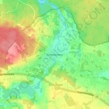
Name: Koleczkowo topographic map, elevation, terrain.
Average elevation: 177 m
Minimum elevation: 138 m
Maximum elevation: 227 m
Thank you for supporting this site ❤️
Make a donation
Make a donation
Other topographic maps
Click on a map to view its topography, its elevation and its terrain.
Thank you for supporting this site ❤️
Make a donation
Make a donation
Łebieńska Huta
Poland > Pomeranian Voivodeship > Wejherowo County > Łebieńska Huta
Average elevation: 195 m
Thank you for supporting this site ❤️
Make a donation
Make a donation