
Bois de Tihange topographic map
Interactive map
Click on the map to display elevation.
About this map
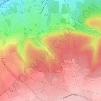
Name: Bois de Tihange topographic map, elevation, terrain.
Location: Bois de Tihange, Tihange, Huy, Liège, Wallonie, 4500, Belgique (50.50599 5.26852 50.52599 5.28852)
Average elevation: 187 m
Minimum elevation: 73 m
Maximum elevation: 256 m
Other topographic maps
Click on a map to view its topography, its elevation and its terrain.