
Kanawha County topographic map
Interactive map
Click on the map to display elevation.
About this map
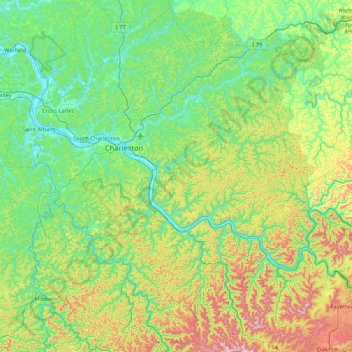
Name: Kanawha County topographic map, elevation, terrain.
Average elevation: 346 m
Minimum elevation: 170 m
Maximum elevation: 869 m
Other topographic maps
Click on a map to view its topography, its elevation and its terrain.
Quick
Vereinigte Staaten von Amerika > West Virginia > Kanawha County
Quick, Kanawha County, West Virginia, Vereinigte Staaten von Amerika
Average elevation: 315 m