
Thank you for supporting this site ❤️
Make a donation
Make a donation
Lordelo topographic map
Click on the map to display elevation.
Thank you for supporting this site ❤️
Make a donation
Make a donation
About this map
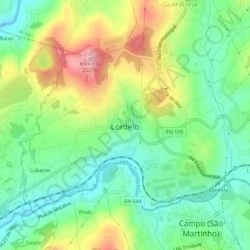
Name: Lordelo topographic map, elevation, terrain.
Location: Lordelo, Guimarães, Braga, 4815-182, Portugal (41.36199 -8.39564 41.38344 -8.35504)
Average elevation: 143 m
Minimum elevation: 76 m
Maximum elevation: 255 m
Thank you for supporting this site ❤️
Make a donation
Make a donation
Other topographic maps
Click on a map to view its topography, its elevation and its terrain.