
Dingras topographic map
Click on the map to display elevation.
About this map
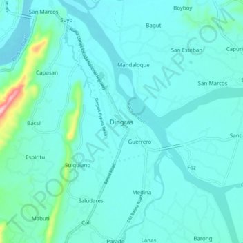
Name: Dingras topographic map, elevation, terrain.
Location: Dingras, Ilocos Norte, Ilocos Region, 2913, Philippines (18.06346 120.65773 18.14346 120.73773)
Average elevation: 41 m
Minimum elevation: 12 m
Maximum elevation: 263 m
Other topographic maps
Click on a map to view its topography, its elevation and its terrain.
Pagudpud
The town's topography includes mountains, hills, valleys and flat coastal land.
Average elevation: 71 m
La Paz Sand Dunes
Philippines > Ilocos Norte > Brgy. 62-B Navotas South > Laoag
Average elevation: 7 m
Pagudpud
The town's topography includes mountains, hills, valleys and flat coastal land.
Average elevation: 73 m