
Gnoien topographic map
Interactive map
Click on the map to display elevation.
About this map
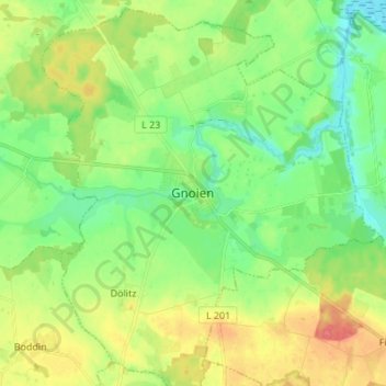
Name: Gnoien topographic map, elevation, terrain.
Average elevation: 23 m
Minimum elevation: -1 m
Maximum elevation: 58 m
Kulturelle Veranstaltungshöhepunke im Jahr sind u. a. das Gnoiener Mühlenfest und das Stiftungsfest der Freiwilligen Feuerwehr.