
Thank you for supporting this site ❤️
Make a donation
Make a donation
Elkhart topographic map
Click on the map to display elevation.
Thank you for supporting this site ❤️
Make a donation
Make a donation
About this map
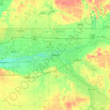
Name: Elkhart topographic map, elevation, terrain.
Location: Elkhart, Elkhart County, Indiana, 46515, United States (41.52199 -86.13667 41.84199 -85.81667)
Average elevation: 247 m
Minimum elevation: 212 m
Maximum elevation: 309 m
Thank you for supporting this site ❤️
Make a donation
Make a donation