
Thank you for supporting this site ❤️
Make a donation
Make a donation
Gemeinde Annaberg topographic map
Click on the map to display elevation.
Thank you for supporting this site ❤️
Make a donation
Make a donation
About this map
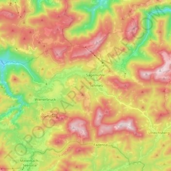
Name: Gemeinde Annaberg topographic map, elevation, terrain.
Location: Gemeinde Annaberg, Bezirk Lilienfeld, Lower Austria, Austria (47.82568 15.26761 47.90289 15.43376)
Average elevation: 964 m
Minimum elevation: 535 m
Maximum elevation: 1,386 m
Thank you for supporting this site ❤️
Make a donation
Make a donation