
Sainj topographic map
Interactive map
Click on the map to display elevation.
About this map
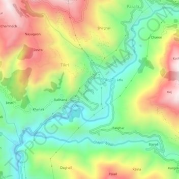
Name: Sainj topographic map, elevation, terrain.
Location: Sainj, Theog, Shimla District, Himachal Pradesh, India (31.05687 77.36876 31.09687 77.40876)
Average elevation: 1,524 m
Minimum elevation: 1,201 m
Maximum elevation: 1,977 m
Other topographic maps
Click on a map to view its topography, its elevation and its terrain.
Kuthar
India > Himachal Pradesh > Theog
Kuthar, Theog, Shimla, Himachal Pradesh, 171226, India
Average elevation: 1,570 m