
Évry-Courcouronnes topographic map
Interactive map
Click on the map to display elevation.
About this map
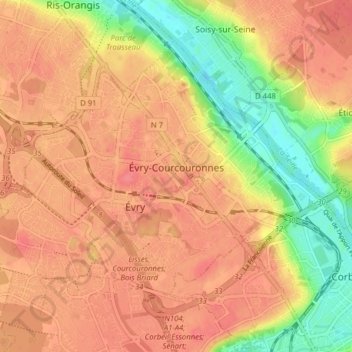
Name: Évry-Courcouronnes topographic map, elevation, terrain.
Average elevation: 71 m
Minimum elevation: 31 m
Maximum elevation: 92 m
Other topographic maps
Click on a map to view its topography, its elevation and its terrain.
Villebon-sur-Yvette
Frankrijk > Île-de-France > Essonne > Villebon-sur-Yvette
Villebon-sur-Yvette, Palaiseau, Essonne, Île-de-France, Metropolitaans Frankrijk, 91140, Frankrijk
Average elevation: 119 m
Ventoux
Frankrijk > Île-de-France > Essonne > Les Ulis
Ventoux, Les Ulis, Palaiseau, Essonne, Île-de-France, Metropolitaans Frankrijk, 91940, Frankrijk
Average elevation: 154 m