
Logan topographic map
Interactive map
Click on the map to display elevation.
About this map
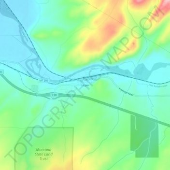
Name: Logan topographic map, elevation, terrain.
Average elevation: 1,294 m
Minimum elevation: 1,243 m
Maximum elevation: 1,413 m
Other topographic maps
Click on a map to view its topography, its elevation and its terrain.
Bozeman
Vereinigte Staaten von Amerika > Montana > Gallatin County
Bozeman, Gallatin County, Montana, Vereinigte Staaten von Amerika
Average elevation: 1,495 m