
Gauschla topographic map
Interactive map
Click on the map to display elevation.
About this map
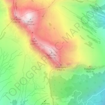
Name: Gauschla topographic map, elevation, terrain.
Location: Gauschla, Wartau, Wahlkreis Werdenberg, Sankt Gallen, Schweiz (47.10122 9.42304 47.10132 9.42314)
Average elevation: 1,789 m
Minimum elevation: 1,321 m
Maximum elevation: 2,338 m