
Thank you for supporting this site ❤️
Make a donation
Make a donation
Al-Buraimi topographic map
Click on the map to display elevation.
Thank you for supporting this site ❤️
Make a donation
Make a donation
About this map
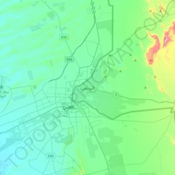
Name: Al-Buraimi topographic map, elevation, terrain.
Location: Al-Buraimi, Al Buraymi Governorate, Oman (24.09919 55.62376 24.41919 55.94376)
Average elevation: 316 m
Minimum elevation: 213 m
Maximum elevation: 867 m
Thank you for supporting this site ❤️
Make a donation
Make a donation