
Thank you for supporting this site ❤️
Make a donation
Make a donation
West Haputale topographic map
Click on the map to display elevation.
Thank you for supporting this site ❤️
Make a donation
Make a donation
About this map
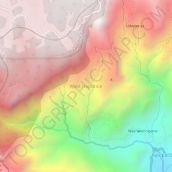
Name: West Haputale topographic map, elevation, terrain.
Location: West Haputale, Badulla District, Uva Province, Sri Lanka (6.76207 80.81094 6.80207 80.85094)
Average elevation: 1,591 m
Minimum elevation: 711 m
Maximum elevation: 2,167 m
Thank you for supporting this site ❤️
Make a donation
Make a donation
Other topographic maps
Click on a map to view its topography, its elevation and its terrain.