
Thank you for supporting this site ❤️
Make a donation
Make a donation
Asti topographic map
Click on the map to display elevation.
Thank you for supporting this site ❤️
Make a donation
Make a donation
About this map
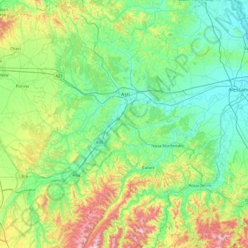
Name: Asti topographic map, elevation, terrain.
Location: Asti, Piedmont, Italy (44.51899 7.88343 45.13300 8.51363)
Average elevation: 261 m
Minimum elevation: 84 m
Maximum elevation: 859 m
Thank you for supporting this site ❤️
Make a donation
Make a donation
Other topographic maps
Click on a map to view its topography, its elevation and its terrain.