
Thank you for supporting this site ❤️
Make a donation
Make a donation
Pocket Creek topographic map
Click on the map to display elevation.
Thank you for supporting this site ❤️
Make a donation
Make a donation
About this map
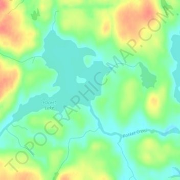
Name: Pocket Creek topographic map, elevation, terrain.
Location: Pocket Creek, Saint Louis County, Minnesota, United States (48.31228 -92.12136 48.31622 -92.12054)
Average elevation: 378 m
Minimum elevation: 355 m
Maximum elevation: 415 m
Thank you for supporting this site ❤️
Make a donation
Make a donation
Other topographic maps
Click on a map to view its topography, its elevation and its terrain.