
Thank you for supporting this site ❤️
Make a donation
Make a donation
Maskehorne Hill topographic map
Click on the map to display elevation.
Thank you for supporting this site ❤️
Make a donation
Make a donation
About this map
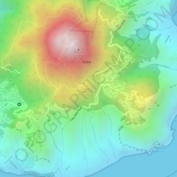
Name: Maskehorne Hill topographic map, elevation, terrain.
Location: Maskehorne Hill, Windwardside, Saba, Nederland (17.62804 -63.23535 17.62814 -63.23525)
Average elevation: 306 m
Minimum elevation: -1 m
Maximum elevation: 847 m
Thank you for supporting this site ❤️
Make a donation
Make a donation