
Thank you for supporting this site ❤️
Make a donation
Make a donation
Shahre Beland topographic map
Click on the map to display elevation.
Thank you for supporting this site ❤️
Make a donation
Make a donation
About this map
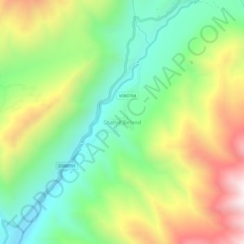
Name: Shahre Beland topographic map, elevation, terrain.
Location: Shahre Beland, Paryan District, Panjshir Province, Afghanistan (35.65575 70.06172 35.69575 70.10172)
Average elevation: 3,120 m
Minimum elevation: 2,709 m
Maximum elevation: 3,751 m
Thank you for supporting this site ❤️
Make a donation
Make a donation
Other topographic maps
Click on a map to view its topography, its elevation and its terrain.