
Thank you for supporting this site ❤️
Make a donation
Make a donation
Arjunpur topographic map
Click on the map to display elevation.
Thank you for supporting this site ❤️
Make a donation
Make a donation
About this map
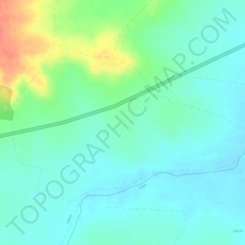
Name: Arjunpur topographic map, elevation, terrain.
Location: Arjunpur, Nandgaon-Khandeshwar, Amravati, Maharashtra, India (20.58193 77.77949 20.59937 77.80803)
Average elevation: 311 m
Minimum elevation: 294 m
Maximum elevation: 349 m
Thank you for supporting this site ❤️
Make a donation
Make a donation
Other topographic maps
Click on a map to view its topography, its elevation and its terrain.
Nandgaon Khandeshwar
India > Maharashtra > Nandgaon-Khandeshwar > Nandgaon Khandeshwar
Average elevation: 302 m