
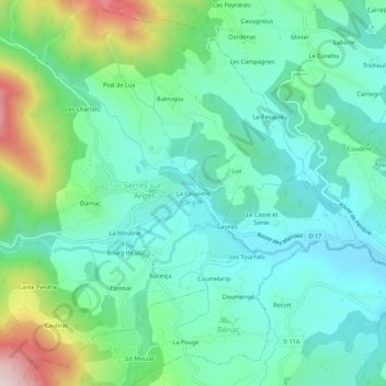
La Coupière topographic map
Interactive map
Click on the map to display elevation.
About this map
Name: La Coupière topographic map, elevation, terrain.
Average elevation: 578 m
Minimum elevation: 450 m
Maximum elevation: 953 m
Other topographic maps
Click on a map to view its topography, its elevation and its terrain.
Bourg de Mat
France > Occitanie > Ariège > Serres-sur-Arget
Bourg de Mat, Serres-sur-Arget, Foix, Ariège, Occitanie, France métropolitaine, 09000, France
Average elevation: 627 m
La Mouline
France > Occitanie > Ariège > Serres-sur-Arget
La Mouline, Serres-sur-Arget, Foix, Ariège, Occitanie, France métropolitaine, 09000, France
Average elevation: 624 m
Darnac
France > Occitanie > Ariège > Serres-sur-Arget
Darnac, Serres-sur-Arget, Foix, Ariège, Occitanie, France métropolitaine, 09000, France
Average elevation: 642 m