
Splügen topographic map
Interactive map
Click on the map to display elevation.
About this map
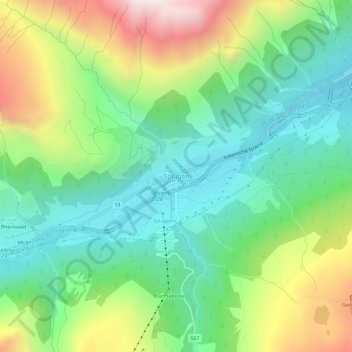
Name: Splügen topographic map, elevation, terrain.
Location: Splügen, Rheinwald, Viamala, Grisons, 7435, Suisse (46.53307 9.30341 46.57307 9.34341)
Average elevation: 1,831 m
Minimum elevation: 1,410 m
Maximum elevation: 2,641 m