
Thank you for supporting this site ❤️
Make a donation
Make a donation
Congaree topographic map
Click on the map to display elevation.
Thank you for supporting this site ❤️
Make a donation
Make a donation
About this map
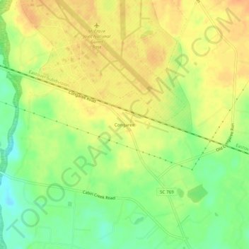
Name: Congaree topographic map, elevation, terrain.
Location: Congaree, Richland County, South Carolina, United States (33.88460 -80.81509 33.92460 -80.77509)
Average elevation: 64 m
Minimum elevation: 42 m
Maximum elevation: 79 m
Thank you for supporting this site ❤️
Make a donation
Make a donation
Other topographic maps
Click on a map to view its topography, its elevation and its terrain.