
Provincia de General Sánchez Cerro topographic map
Interactive map
Click on the map to display elevation.
About this map
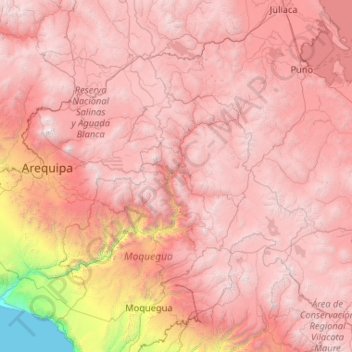
Name: Provincia de General Sánchez Cerro topographic map, elevation, terrain.
Average elevation: 3,660 m
Minimum elevation: 2,598 m
Maximum elevation: 4,714 m