
Thank you for supporting this site ❤️
Make a donation
Make a donation
Upper Tominobo topographic map
Click on the map to display elevation.
Thank you for supporting this site ❤️
Make a donation
Make a donation
About this map
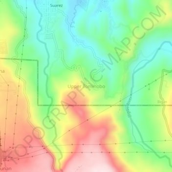
Name: Upper Tominobo topographic map, elevation, terrain.
Location: Upper Tominobo, Iligan, Northern Mindanao, Philippines (8.15275 124.20432 8.19275 124.24432)
Average elevation: 166 m
Minimum elevation: 18 m
Maximum elevation: 370 m
Thank you for supporting this site ❤️
Make a donation
Make a donation
Other topographic maps
Click on a map to view its topography, its elevation and its terrain.