
Grensberg topographic map
Interactive map
Click on the map to display elevation.
About this map
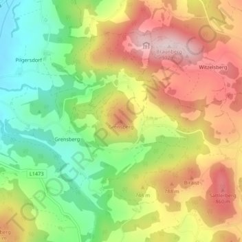
Name: Grensberg topographic map, elevation, terrain.
Location: Grensberg, Lasberg, Bezirk Freistadt, 4291, Österreich (48.47168 14.57995 48.47178 14.58005)
Average elevation: 727 m
Minimum elevation: 565 m
Maximum elevation: 899 m
Other topographic maps
Click on a map to view its topography, its elevation and its terrain.
Paben
Österreich > Bezirk Freistadt > Lasberg
Paben, Lasberg, Bezirk Freistadt, 4291, Österreich
Average elevation: 699 m